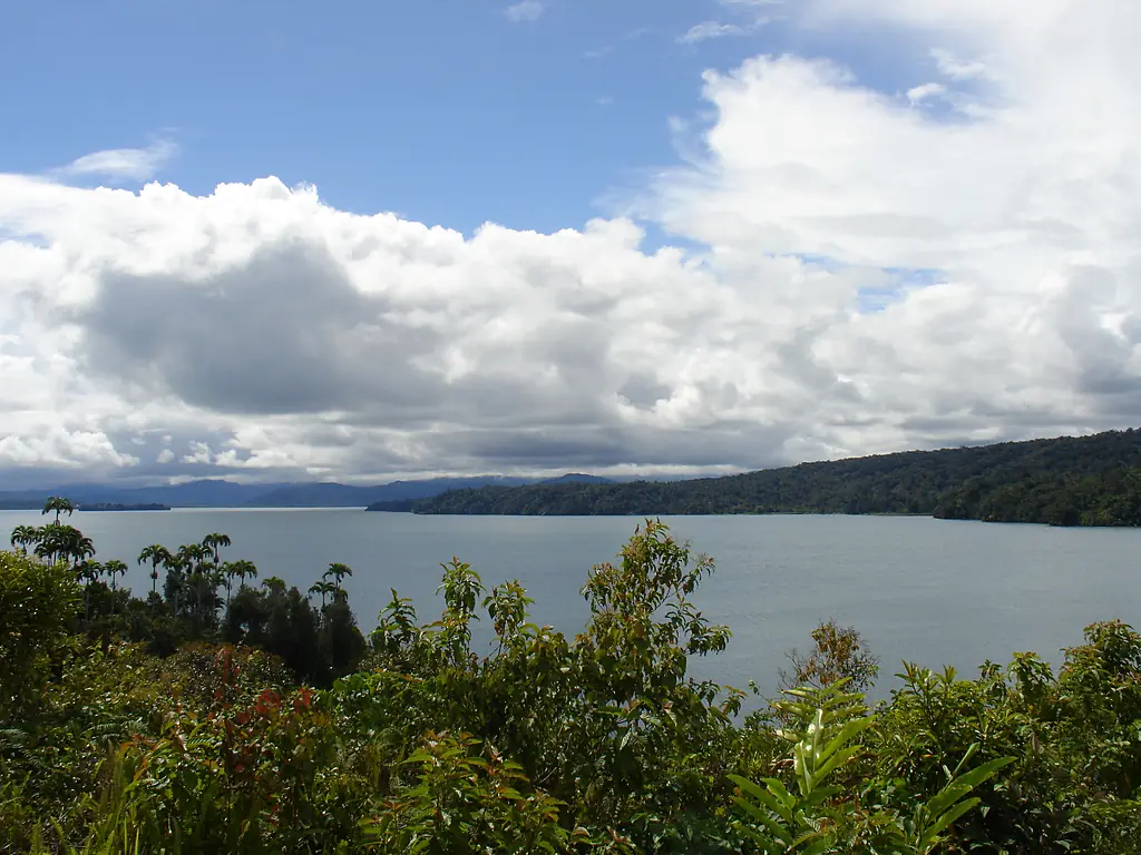
 Papua New Guinea Ramsar wetland
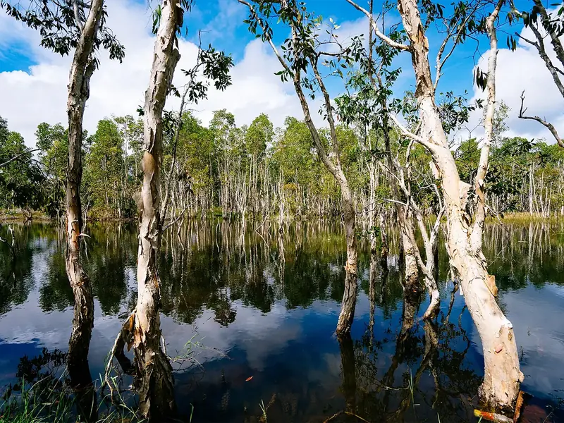
Lake Kutubu
33 bird species recorded; the most in December.
Iain Taylor1 · CC BY 2.0
This month here
0 species in January.0 species in February.24 species in March.0 species in April.0 species in May.0 species in June.0 species in July.0 species in August.16 species in September.0 species in October.0 species in November.27 species in December.
The birds you are most likely to see in the month you choose, those that come for the season first. It opens on today's month.
No records for this month.
No records for this month.
No records for this month.
No records for this month.
No records for this month.
No records for this month.
No records for this month.
No records for this month.
No records for this month.
- Resident all year
- Summer visitor comes to breed
- Winter visitor comes for the winter
- Passage migrant in spring and autumn
In numbers
33 species, counted.
Our own rating, from the records only: species (50 points), threatened species (20), migrants (20) and protected status — Ramsar, IBA, SPA, observatory (10).
- 33Speciesrecorded more than once
- 4Migrantssummer, winter or passage visitors
- 0ThreatenedVulnerable, Endangered or Critically Endangered (IUCN)
- 220Recordsopen records within 6 km
- 824 mAltitudeabove the sea
- 2Raptors
- 4Herons, ibises & grebes
- 16Songbirds
- 11Other birds
From open records (eBird and others, through GBIF, licensed for any use). More birdwatchers mean more records: a quiet place may have more birds than it shows.
The checklist
All 33 species.
By group, with the year in twelve cells: the darker the cell, the more often the bird is recorded that month.
Raptors2 species
- Brahminy KiteHaliastur indus
- Pacific BazaAviceda subcristata
Herons, ibises & grebes4 species
- Nankeen Night HeronNycticorax caledonicus
- Little EgretEgretta garzetta
- Egretta intermediaEgretta intermedia
- Little Pied CormorantMicrocarbo melanoleucos
Songbirds16 species
- Little Shrike-thrushColluricincla megarhyncha
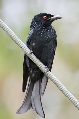
- Spangled DrongoDicrurus bracteatus
- Grey WhistlerPachycephala simplex
- Grey CrowCorvus tristis
- Red-capped FlowerpeckerDicaeum geelvinkianum
- Helmeted FriarbirdPhilemon buceroides
- Tawny-breasted HoneyeaterXanthotis flaviventer
- White-shouldered FairywrenMalurus alboscapulatus
- Brown orioleOriolus szalayi
- Yellow-faced MynaMino dumontii
- Hooded ButcherbirdCracticus cassicus
- Great WoodswallowArtamus maximus
- Willie-wagtailRhipidura leucophrys
- Northern FantailRhipidura rufiventris
- Black SunbirdLeptocoma sericea
- Black ButcherbirdMelloria quoyi
Other birds11 species
- Sacred KingfisherTodiramphus sanctus
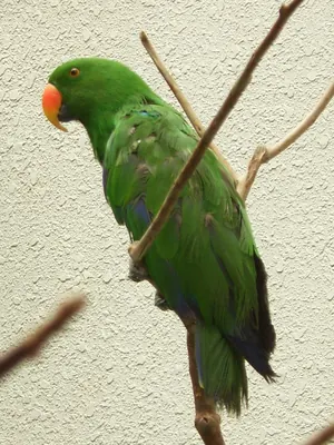
- Eclectus ParrotEclectus roratus
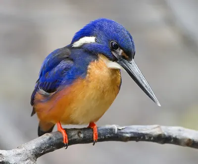
- Azure KingfisherCeyx azureus
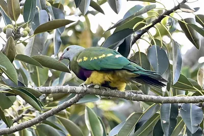
- Wompoo Fruit DovePtilinopus magnificus
- Red-necked CrakeRallina tricolor
- Blyth's HornbillRhyticeros plicatus
- Mountain SwiftletAerodramus hirundinaceus
- Glossy SwiftletCollocalia esculenta
- Palm CockatooProbosciger aterrimusNT
- Red-cheeked ParrotGeoffroyus geoffroyi
- Coconut LorikeetTrichoglossus haematodus
Monthly presence relative to all bird records that month, so a busy month does not inflate every species.
When to go
The most species in December.
Species recorded in each month, with the usual temperature and rain.
- Jan25°/18°282 mm
- Feb24°/18°277 mm
- Mar24°/18°346 mm
- Apr24°/19°333 mm
- May24°/19°265 mm
- Jun24°/18°213 mm
- Jul23°/17°157 mm
- Aug24°/17°148 mm
- Sep24°/18°190 mm
- Oct25°/18°170 mm
- Nov25°/19°233 mm
- Dec25°/19°291 mm
- Bar: species recorded that month.
- Temperature: average maximum / minimum (NASA, 1991–2020).
- Rain: monthly total.
The place
Lake Kutubu.
Lake in Papua New Guinea
Lake Kutubu is a wetland of international importance (Ramsar) in Papua New Guinea, 824 m above the sea.
33 bird species have been recorded here more than once, in 220 open records.
The most recorded are the Sacred Kingfisher, the Eclectus Parrot and the Azure Kingfisher.
4 species come for the summer, 0 for the winter and 0 only pass through.
The most species are recorded in December.
Get there and watch
- Tobu Lodgeplace to stay · 1.7 km · 1 within 10 km
- Mendi Airport (MDU)nearest airport with scheduled flights · 45 km in a straight line
Plan the visit
A guided walk, a bed nearby, a car.
Some links above are affiliate links: if you book through them we may earn a commission, at no extra cost to you. It never changes what the data on this page says.
From above
The place and its surroundings.
The satellite image of the 6 × 6 km around the place, with the bird hides, towers and trails that OpenStreetMap shows.
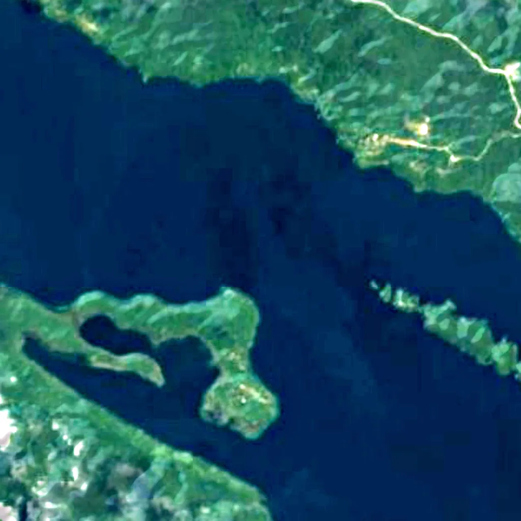
Around, in OpenStreetMap
- 1places to stay within 10 kmTobu Lodge
- bird hides within 6 km
- observation towers within 6 km
- marked trails within 4 km
- visitor centres within 6 km
- viewpoints within 5 km
- car parks within 3 km
- restaurants and cafés within 3 km
- campsites within 10 km
Counted in OpenStreetMap, the map anyone can edit. A low number may just mean nobody has mapped it yet.
In our other atlases
Around Lake Kutubu.
The lakes, beaches, islands, rivers and mountains around this place, and its night sky, in the family's atlases.
 Peakyas5 mountains within 25 km
Figures from the sister sites' databases (Wikidata, HydroATLAS, GeoNames, OpenStreetMap). Links open when each site is online.
Other places nearby.
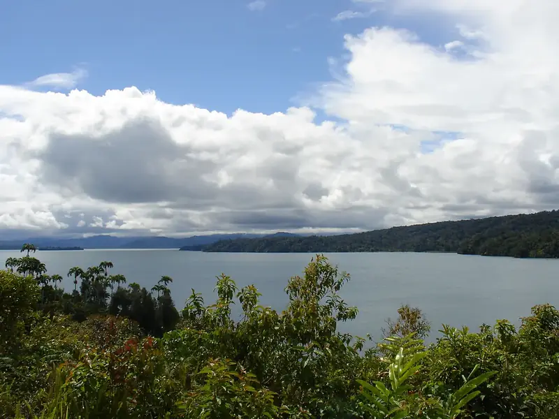
Lake Kutubu
Papua New Guinea
- 32Birdyas Score
- 33Species
- 4Migrants
- 0Threatened
Where these figures come from
| Name and type | Wikidata (Q1800976) · CC0 |
|---|---|
| Birds | 220 open bird records within 6 km (GBIF, CC0 and CC BY 4.0 only; mostly eBird, Cornell Lab of Ornithology) |
| See these records | gbif.org |
| Species | GBIF Backbone Taxonomy · CC BY 4.0; Wikidata (CC0); Wikimedia Commons |
| Altitude | Copernicus DEM GLO-30 · © DLR e.V., © Airbus Defence and Space GmbH, Copernicus/ESA |
| Temperature and rain | NASA POWER (CERES SYN1deg, 2001–2020; MERRA-2) |
| What is around | © OpenStreetMap contributors · ODbL |
| Images | EOX Sentinel-2 cloudless 2016 · CC BY 4.0; Wikimedia Commons |
| Sister atlases | Peakyas, Islandyas, Lakeyas |
Every figure is an average, an estimate or a count from a public dataset. Licences and methods: data sources.
The family
Do you prefer beaches, lakes, mountains, waterfalls, islands, rivers, canyons, caves, dark skies, viewpoints, birdwatching or forests?
Same idea, other landscapes: field atlases built on open data, in seven languages.
 beaches
 Find your beach: sea temperature, sun and swimming month by month.Visit
  lakes
lakes Every lake on Earth: water temperature, ice, depth and the shore.Visit mountains
 Every summit in 3D: summit weather, the 0 °C line, huts and trails.Visit
  waterfalls
 Every waterfall: height, flow month by month and when it roars.Visit
  islands
 Every island from the sea up: size, sea temperature, ferries and 3D.Visit
  rivers
 Every river from source to sea: the journey, the flow and the basin in numbers.Visit
  canyons
 Every canyon cut to scale: depth to the floor, rim and floor temperatures, trails and viewpoints.Visit
  caves
caves Every cave with its real depth and length: the rock above, the temperature inside all year, and how to visit.Visit
  dark skies
 Where the night is still dark: the sky of every place, the Milky Way month by month, the Moon, eclipses and auroras.Visit
  viewpoints
 Every viewpoint with its real 360° panorama: the peaks you can name, how far you see and where the sun sets.Coming soonVisit
  birdwatching
 Every bird sanctuary and wetland with the species recorded month by month: who is resident, who comes for the summer, who only passes through.You are here
 forests
 Every forest with its land-cover rings, what grows and lives in it, and the best months to walk it.Coming soonVisit